Phase 4 Thorong La Pass
Wouter Martens
Phase 4: Thorong La Pass (2 Days)
It was time for the stages leading to the highest pass of the Annapurna Circuit Track. By now, we were well-acclimatized to the altitude, and the climbing didn’t feel any different, even though we were at a considerable height. Our bodies were well-prepared for the high Himalayas!
Stage 12: Shreekarka – Thorang Phedi (17.2 km)
Freshly rested, we woke up the next morning and, with a good breakfast in our stomachs, we set off on a new path from Shreekarka, crossing over to the trail from Manang to Thorang Phedi. To do this, we first walked uphill toward Upper Khangsar, which turned out to consist of only a few ruins.
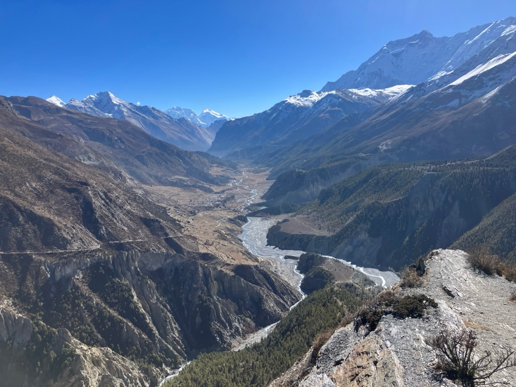
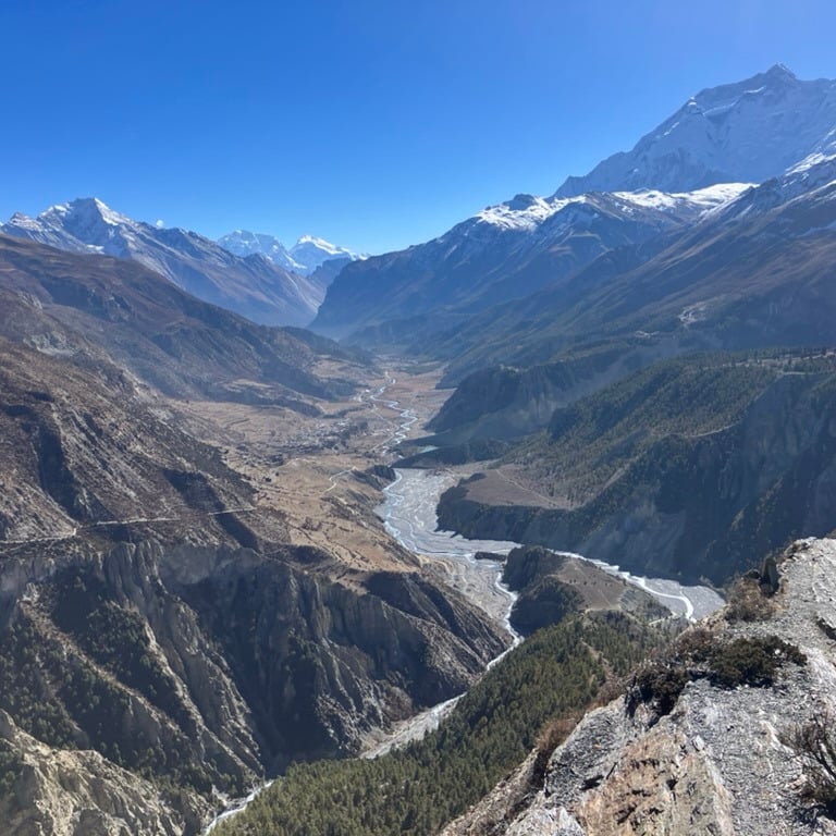
It was a beautiful winding path with occasional yaks on the side. We walked through a reddish-brown landscape with occasional low shrubs in the same colors as the vegetation. At one point, we came over a ridge and saw the other valley, looking all the way down toward Manang. The weather was beautiful again, and we could see almost 360 degrees around us. It was one of the most stunning views of the route: to the right lay the valley we had just walked all the way to the top (the lake), to the left the valley that would lead us to the pass of the ACT, and straight ahead, the large, wide valley towards Manang that we had also walked through.
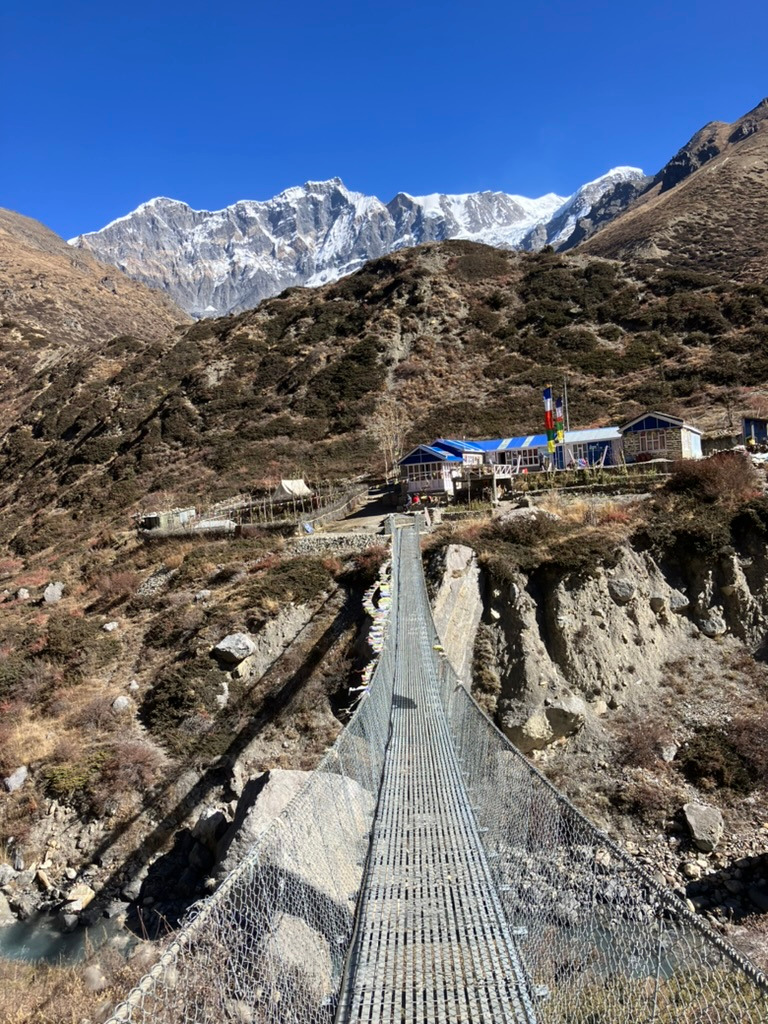
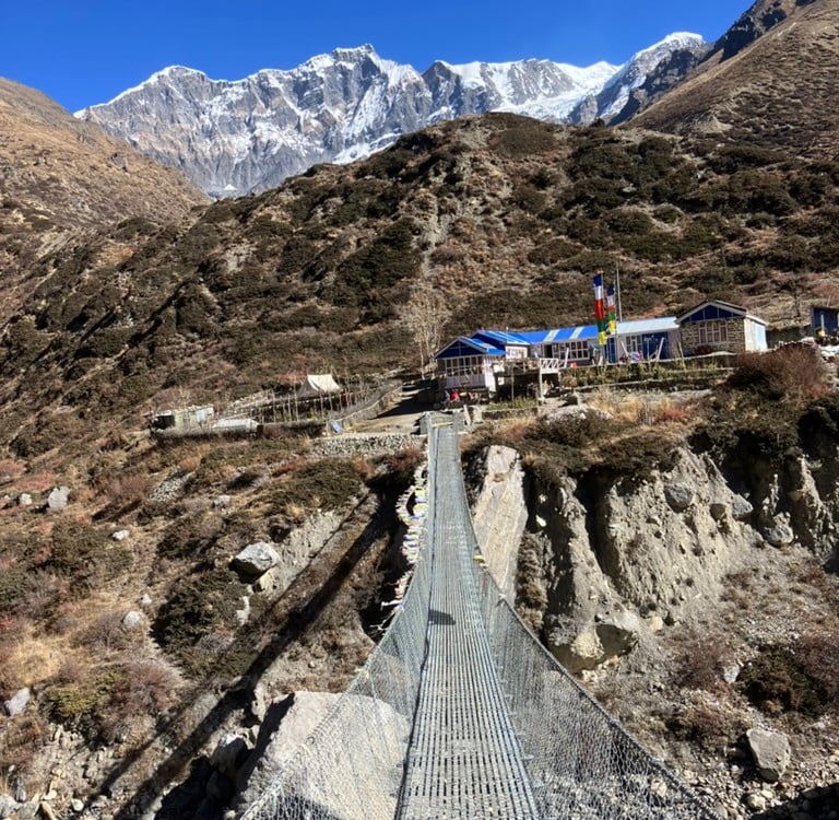
After this, there was a considerable descent towards a suspension bridge to cross to the other side of the valley. On the other side of the bridge, there was a steep climb until we reached the wider path toward Yak Kharka. After that, it was a relatively flat path where many horses were returning to Manang. After a few kilometers, we arrived in Yak Kharka, where we found a wonderful spot for an extensive lunch and a game of chess.
My friends were a bit tired from the past few days and wanted to stay overnight there, but I felt like continuing to Thorang Phedi. So, after lunch, I set off alone to climb the last part of the valley upward. On both sides of the valley, you can walk, and I chose the left route.
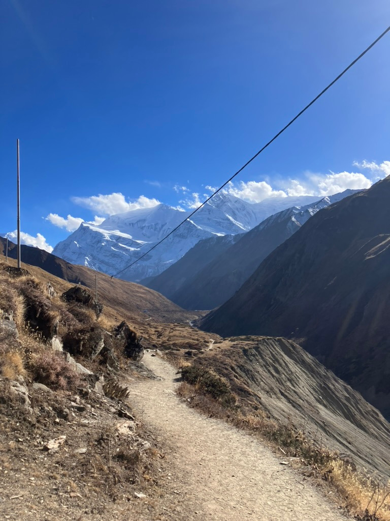
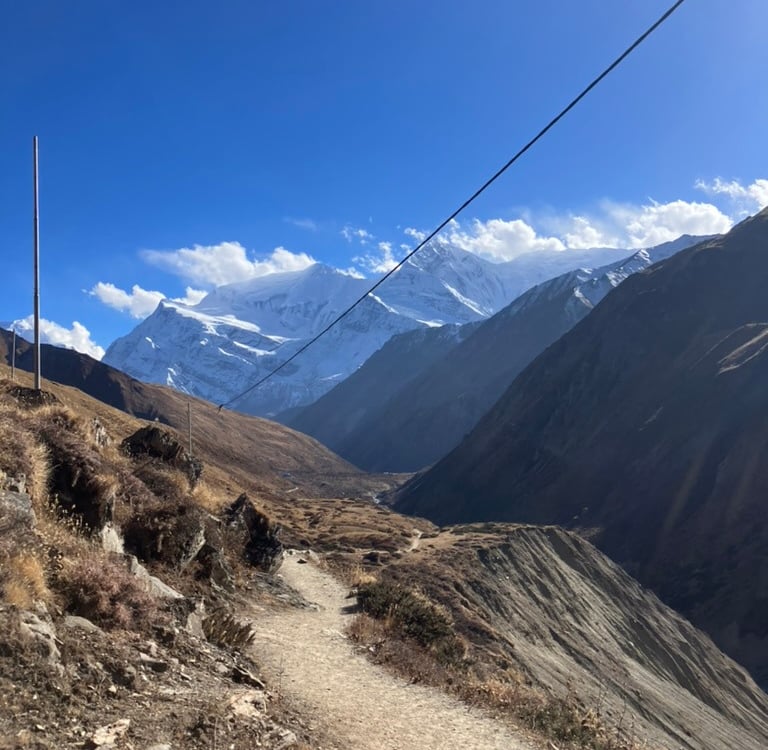
I took the first suspension bridge to the other side and walked steadily upward toward Thorang Phedi. The red, steep mountain walls became more and more impressive, and the sun disappeared behind them, making it colder. At the end of the afternoon, I arrived at the guesthouses at the bottom of the last route toward the pass and found a room for myself.
I met some friends and played games with them, warming up with good food. Then, I went to bed early because I had to get up early for the final stretch to the top. I had walked over 17 km with 1,037 meters of elevation gain and slept at an altitude of 4,540 meters.
Stage 13: Thorang Phedi – Thorong La Pass – Muktinath (15 km)
It was the day of crossing the pass. At 5 a.m., I got up in the pitch dark and quickly enjoyed a small breakfast in the common room, where other hikers, bundled up in all their layers, were already trying to warm up. I decided to walk alone so I could maintain my own pace going uphill.
I didn’t have a headlamp with me, but since there were various groups hiking upward, I could still see where I was going. It was a beautiful zigzag path, fairly steep upward. I overtook quite a few groups along the way, and just before 6 a.m., light began to appear in the sky, immediately reflected by the snow-capped mountains and patches of snow along the route.
I reached High Camp around 6 a.m. and continued the route to the left after passing a few buildings. I caught up with some familiar groups, and it gradually grew lighter around me. The path consisted mainly of rubble and stones, with a thin layer of snow on the slopes around me. Occasionally, I passed a flag, and there were even small houses where you could enjoy a cup of tea. The path rose steadily, and the wind was blowing quite hard at times. But otherwise, it was manageable and not too cold as long as I kept moving.
Around 7 a.m., I saw the sunlight appear on the snow-capped peaks around me, and the world became even more beautiful. Soon, the path was also covered with a layer of ice, and the entire environment turned white. We were still climbing steadily, but I didn’t really struggle with the altitude as long as I kept walking calmly. The acclimatization had worked well over the past week.
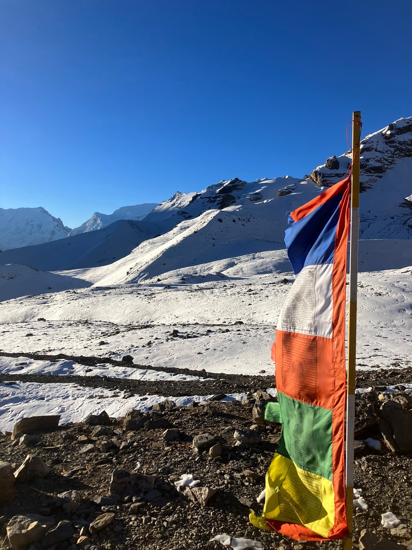
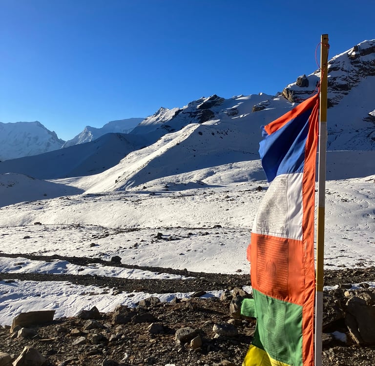
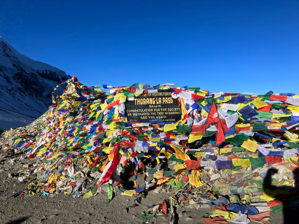
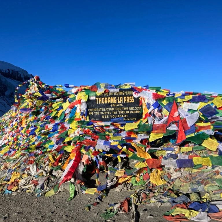
With the sun on my back, I reached Thorong La Pass at 7:44 a.m., at an altitude of 5,416 meters. At the top, it was windy, and I took a few photos of the beautiful flags and the surroundings before quickly putting my gloves back on. I warmed up for a few minutes in the small house at the top and chatted with some other hikers who were happy to have reached the summit.
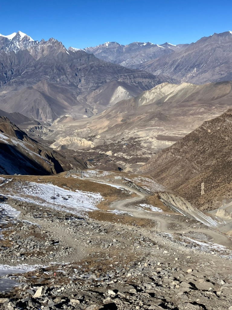
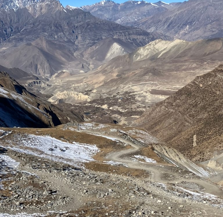
Then, at 8:00 a.m., I began the long descent to the other side. To my left were the even higher white peaks and glaciers sliding down from them. The path was somewhat slippery at first but still manageable. Soon, there was no more snow on the path, only on the slopes beside it and occasionally in a shady spot.
The sky was beautifully blue again, and the sun slowly rose higher. It became noticeably warmer; at the top, it had been about -10°C, but the descent and the sun ensured it was no longer freezing. I could see the route clearly downward and a bit further to the next row of mountains. On this side of the mountain pass, it was clear that less precipitation fell, making the mountains less vegetated and giving them beautiful red and brown colors.
The descent ultimately lasted longer than the ascent, and by around 11:00 a.m., I arrived in Muktinath. Muktinath provided a small culture shock because it was a fairly large and lively place where a religious festival was taking place, making it extra busy with local Hindus. After weeks of very quiet mountain villages with Buddhist Nepalese, this was a completely different side of Nepal.
I quickly found a nice hostel with a wonderful warm shower and divine apple pie. After a few hours, friends arrived, and we drank a rare beer together to celebrate the successful crossing. Ultimately, I had walked 15 km with 870 meters of elevation gain but also with a descent of over 1,800 meters. I slept in Muktinath at an altitude of 3,670 meters.