Phase 3 Tilicho Lake
Wouter Martens
Phase 3: Tilicho Lake (2 Days)
From Manang, you can reach the top of the Thorong La Pass in 2 or 3 days. But we chose to do a side mission to Tilicho Lake, which many, including myself, consider the most beautiful part of the ACT. Tilicho Lake is a lake at 5,000 meters altitude, surrounded by glaciers and high snow walls. It is located in the valley next to that of the Thorong La Pass.
Stage 10: Manang – Tilicho Lake Base Camp (14.8 km)
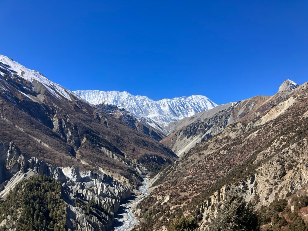
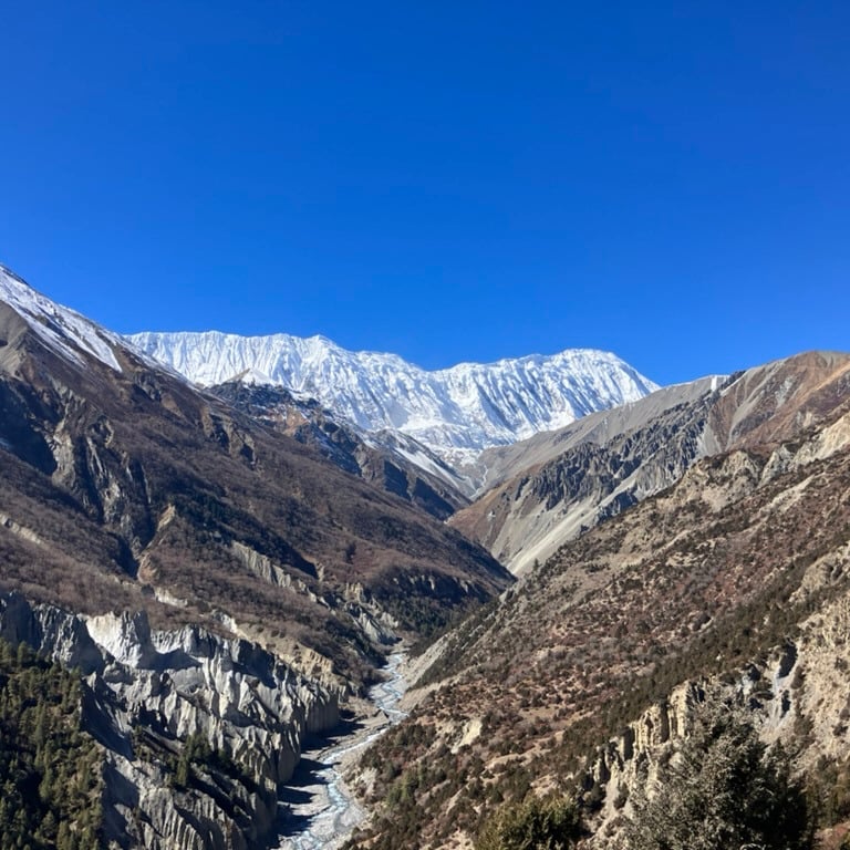
From Manang, you start at the gate in the north of the town toward the mountains. You immediately see the two valleys next to each other. On the left side is the valley toward Tilicho Lake and its associated glaciers. On the right is the valley toward the Thorong La Pass. We choose the route to the left toward Khangsar.
The route takes you over a dusty path toward the lower river. We stayed on the right side of the river and climbed slowly upward. After a few kilometers, we crossed the river via a long suspension bridge. After the bridge it was a few kilometers of steep climbing toward the village of Khangsar, a mini-village with mainly guesthouses for hikers.
After a short break, we walked further on the path on the right side of the valley. We continued climbing for several kilometers. After a while, we arrived at a beautiful stupa and, after another steep section, at the village of Shreekarka. Along the way, we could see the white glaciers due to the beautiful weather, with the red mountains around the river, steep walls, and many rocks in front of them.
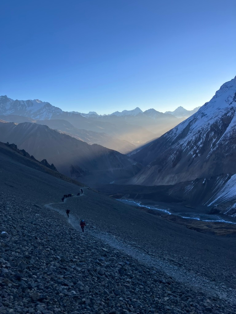
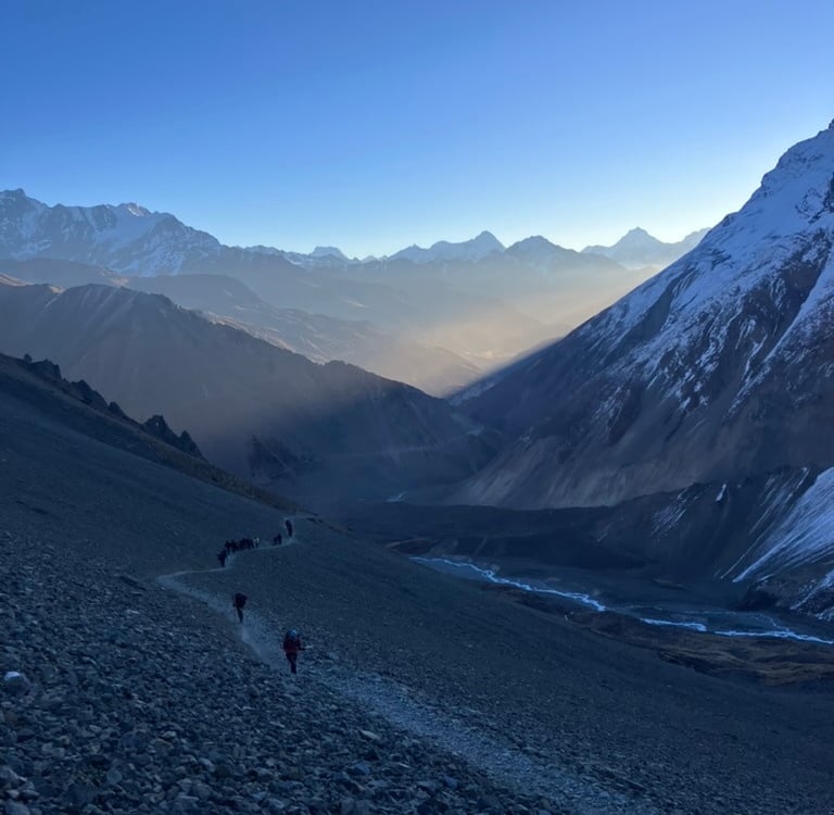
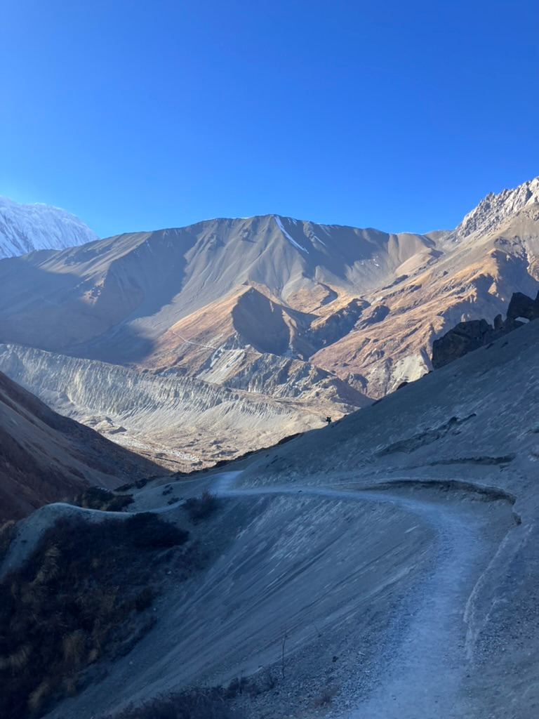
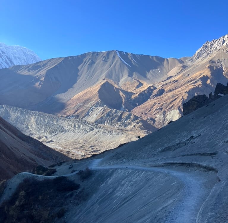
In Shreekarka, we ordered a good lunch because, after all that climbing (over 700 meters and already at 4,100 meters altitude), we were hungry. After a game of chess during lunch, we walked further towards Tilicho Lake Base Camp. We alternately climbed and descended on a magnificent path across a steep wall. There were also quite a few oncoming hikers. In addition to hikers like us, many local people had taken the route to Tilicho Lake that morning, waving with Nepalese flags and occasionally singing with joy on their way back.
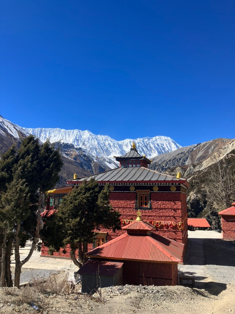
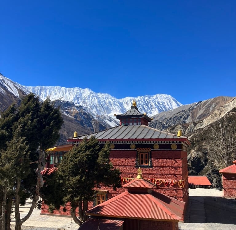
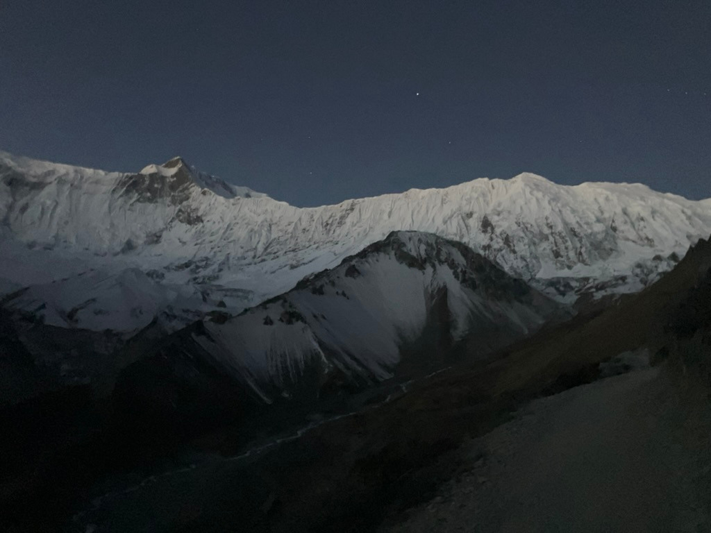
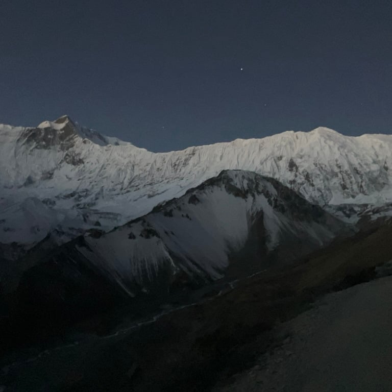
The path became more and more challenging toward the end. We had to climb along steep walls and sometimes almost straight down and straight up, always between large stones and rock walls. At some point, the valley turned toward the glacier, and we could see Tilicho Base Camp lying there, just illuminated by the last rays of sun of the day.
This is a very spectacular route that I would recommend every hiker to take. In Tilicho Base Camp, we found one of the colorful guesthouses and settled inside in the common room for hot chocolate and an extensive Dal Bhat meal. We went to bed early under two thick blankets because we had to get up extra early the next morning to start climbing on time. That day, we had walked almost 15 km with 950 meters of elevation gain and slept at 4,140 meters altitude.
Stage 10: Tilicho Base Camp – Tilicho Lake – Shreekarka (17.1 km)
We woke up early and started hiking at 5:30 a.m. From the base camp, the trail went straight uphill. The lake is at 5,000 meters, so we had to climb over 800 meters in just 5 km.
At first, it was still dark, and we could see the headlamps of other hikers dancing above us. But soon, it slowly got lighter, and especially the snow-capped mountain peaks on the other side of the valley began reflecting the light. After an hour of hiking, the sun truly came up, and the peaks were already beautifully lit by the sunlight.
After 3 kilometers of steady climbing, we reached a zigzag path that climbed steeply upward. At the end of the zigzag path, we were on a plateau, and everything was already covered in snow and ice. Now, there were still 500 meters to go to the lake, but the giant mountains on the left side looked impressive. Occasionally, we heard the rumbling of avalanches coming down.
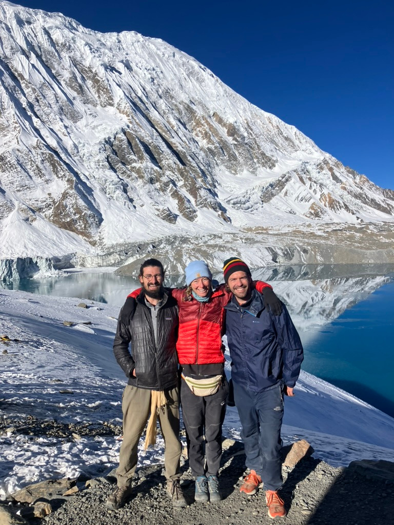
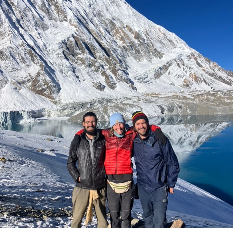
When we arrived at the lake, the spectacle became even more beautiful. In hindsight, this was one of the most stunning sights of the entire ACT. The glacier that flowed into the partially frozen lake looked threatening and rumbled loudly due to avalanches. After taking some photos and enjoying the surroundings with a small snack, we walked the same path back toward the base camp. By then, the trail was bathed in beautiful sunshine, and we descended much faster than on the way up.
At the base camp, we packed our things and walked the same route back towards Shreekarka. Since this part of the route is used in both directions, we met all the people we had already seen who were walking toward us, just like yesterday but in the opposite direction.
We arrived in Shreekarka around 2:00 p.m. and decided to stay overnight there since we had gotten up so early. We played games for the rest of the afternoon and enjoyed a delicious meal at the Himalaya Hotel. In just over 17 km, we had climbed 1,155 meters and reached a new maximum altitude of 5,005 meters at the lake.