Phase 5 Muktinath - Tatopani
Wouter Martens
Phase 5: Muktinath – Tatopani (3 Days)
The pass had been conquered, and the descent had begun. The landscape was completely different now, and I could keep walking through it. Many hikers with less time choose to take a bus back to Pokhara or other destinations from here. But I decided to keep walking as much as possible.
Stage 14: Muktinath – Marpha (27 km)
This stage turned out to be the least enjoyable of the entire ACT, even though it started beautifully. After a wonderful breakfast with apple pie, I set off alone. Most hikers have less time and choose to take a bus back to Pokhara or skip a few stages from here.
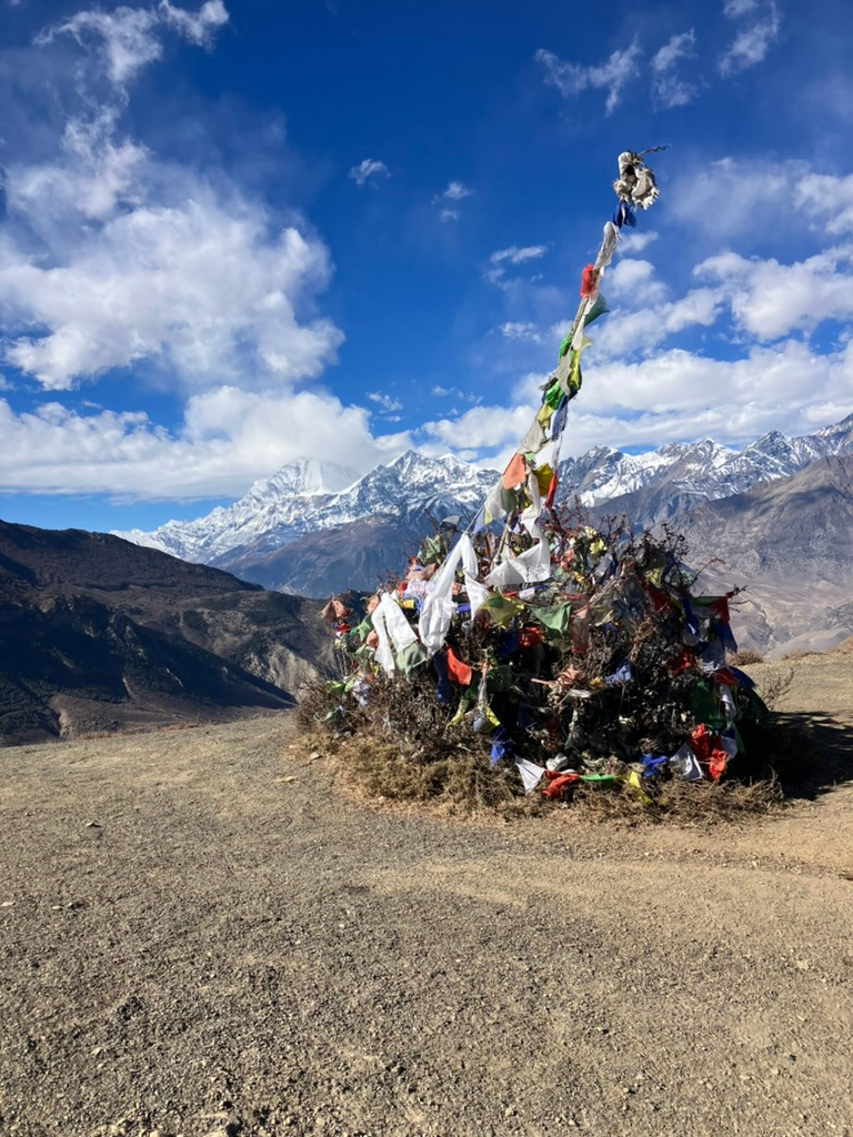
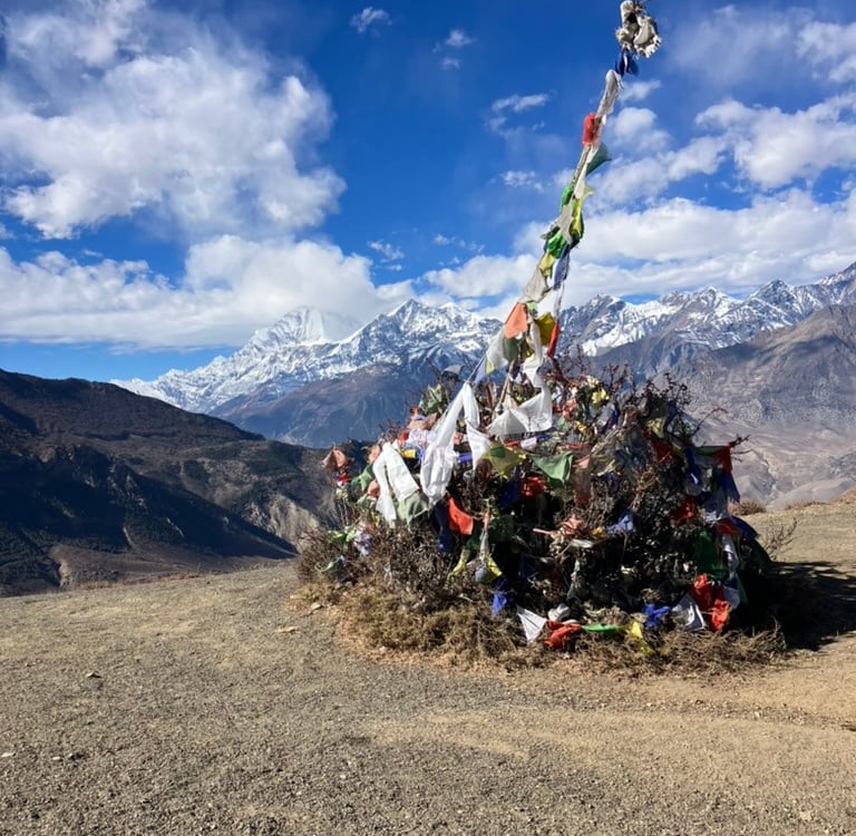
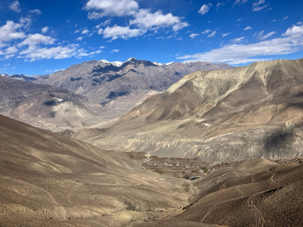
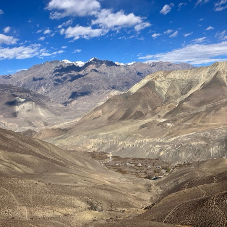
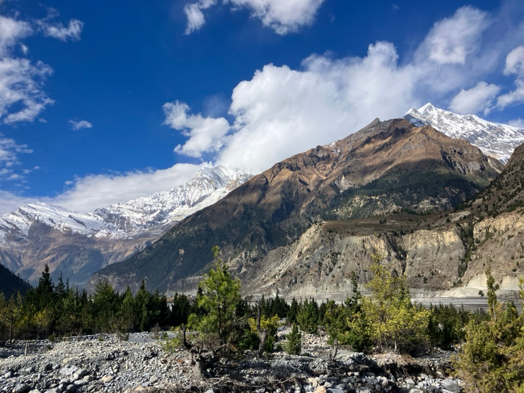
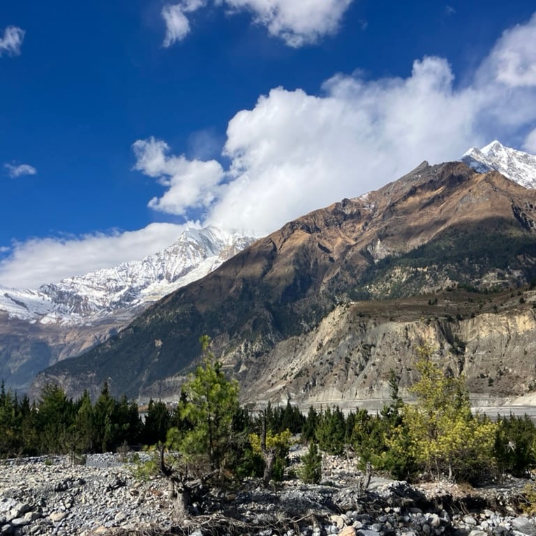
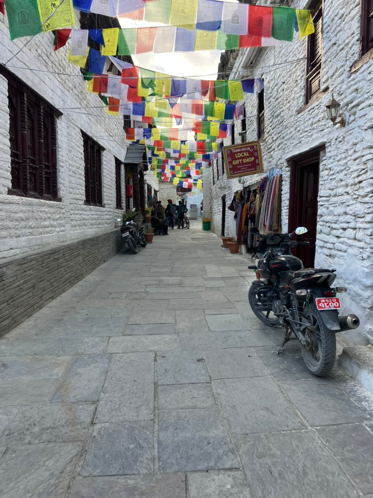
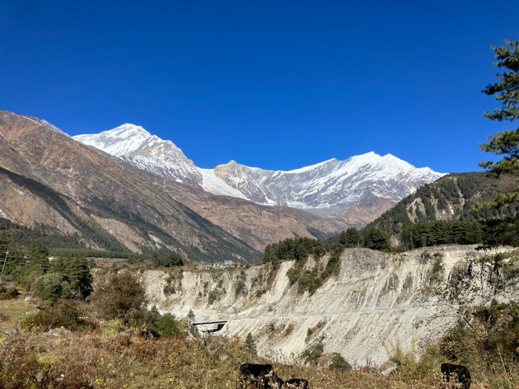
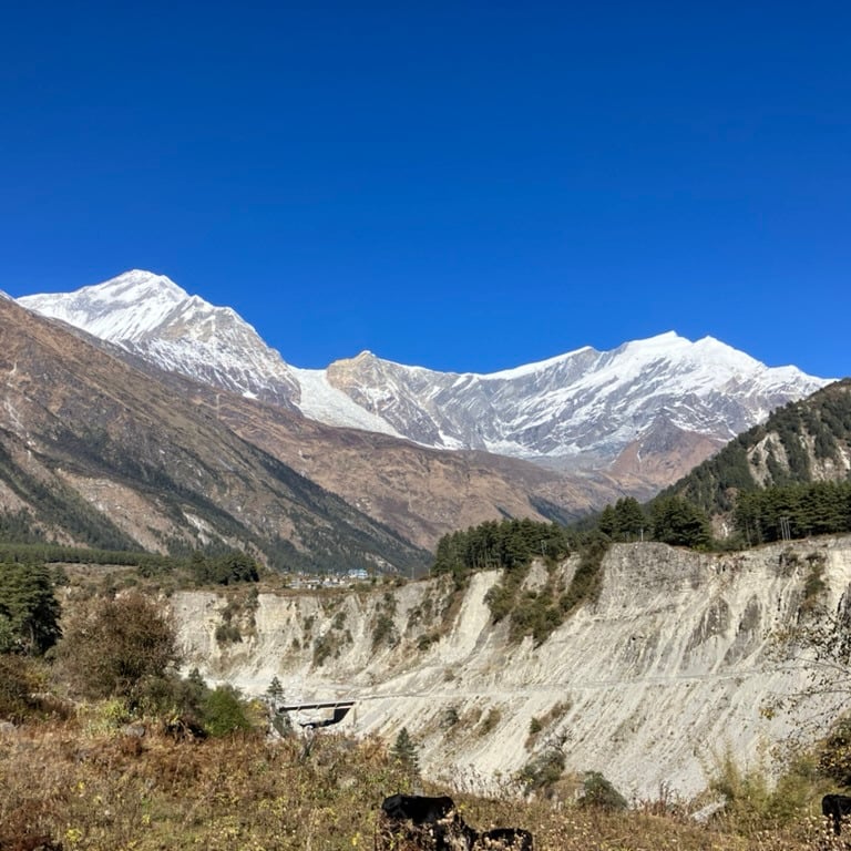
I had all the time in the world and decided to walk as much as possible. From Muktinath, I walked through the busy bus station into the reddish-brown barren mountains toward the west. The view was truly magnificent, looking toward Dhaulagiri (an 8,000-meter peak) on the other side of the valley and the high white peaks of the Annapurna massif. There was a clear, beautiful path leading to Lupra.
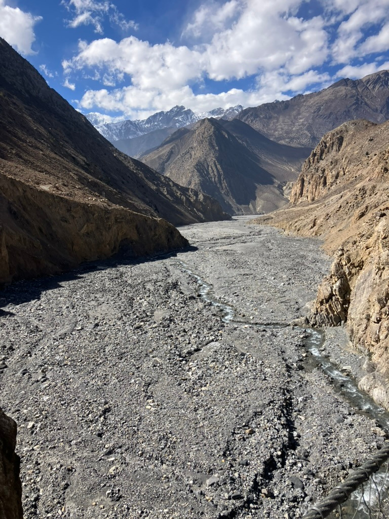
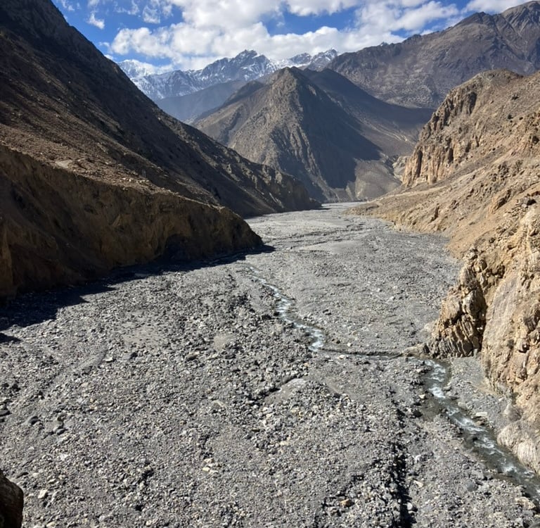
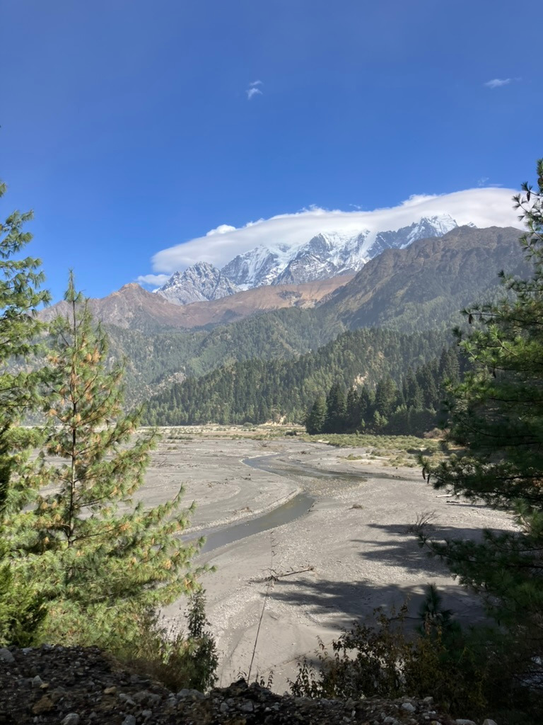
At first, the trail was gently rolling, but after another climb and a stunning viewpoint, it descended steeply. I only met one other hiker on the entire route, along with an occasional herder with his animals. After descending for a while, I could see the valley of a tributary coming from the mountains. Since it doesn’t rain much in November and it gets colder in the mountains, it was just a small stream in the deep riverbed.
To get to Lupra, I had to cross the riverbed. I found a spot to walk to the other side and arrived in a half-asleep village where I found a nice little restaurant for a delicious lunch. The other hiker from the day joined me a little later at the same restaurant.
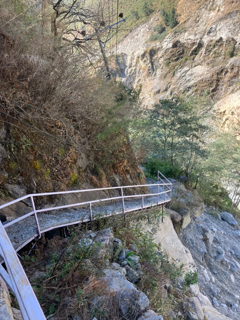
The path on this side of the stream was no longer passable due to landslides, so after lunch, I had to cross back to the other side to reach the main road toward Jomsom. I also walked a considerable part on the dry riverbed, and there wasn’t really a clear path.
When I reached the main road, the less enjoyable part of the day began. It was quite windy, and occasionally, jeeps and motorcycles drove on the road, kicking up a lot of dust that didn’t agree with my eyes. Towards Jomsom, I sometimes walked in the gigantic riverbed on the right side of the road, where only a very small part was used for a stream, and sometimes on the left side of the road, where the original hiking trail was. However, it was very poorly maintained, and it was clear that it was unusual to walk this section.
In Jomsom, there was another ACT checkpoint where my pass was stamped. Jomsom is a fairly large but boring town, and I wanted to sleep in Marpha because it’s a nice and lovely village. However, I made the mistake of wanting to walk this last part of the day as well. On the Maps.me app, I saw a path that ran via the left bank of the river. This turned out to be a dead-end path leading to a bridge that no longer existed.
So, I walked a considerable distance for nothing before turning back. A few kilometers back, I found a bridge to the other side and then still had to walk on the main road to Marpha, with all the dust clouds included.
My tip: Do sleep in Marpha, but take a bus from Jomsom to Marpha because this 5 km stretch is not worth walking.
At the end of the afternoon, I arrived in Marpha with red eyes. It turned out to be a really beautiful village, and I enjoyed the food in the small streets after a good shower to get the dust off me. It was a day with a lot of descending, and I ended at approximately 2,700 meters altitude after 27 km, with over 500 meters of elevation gain and over 1,000 meters of descent.
Stage 15: Marpha – Kalopani (19.2 km)
Marpha is known for its delicious apples, so I took a few with me as I started my day’s journey through the narrow, charming streets. It was lively with children heading to school and waving me goodbye as I left the village.
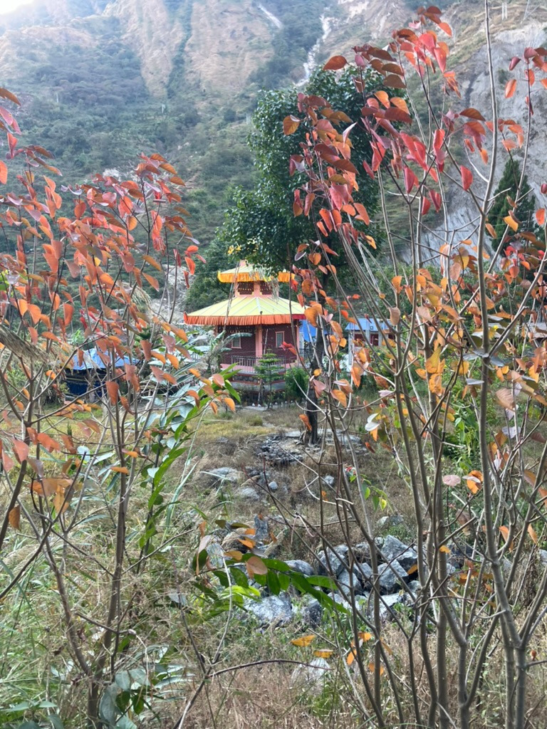
After about 1.5 km, I crossed a bridge to the other side of the river, leaving the main road behind for the rest of the day. I walked on the beautiful path along the left bank of the river. Right after the bridge, there was a refugee camp for Tibetans, where a few small items were being sold.
A lovely stone path led me gradually downward, with occasional views of the slightly wider river on my right. There was more and more vegetation, and the landscape was becoming a bit greener. The stone path transitioned into a regular hiking trail, with occasional small hills or bridges over tributaries.
The signs were sometimes a bit confusing, with inconsistent walking times that didn’t seem accurate, but otherwise, the path was perfectly fine. Just before lunch, there was a steep little climb, but the rest of the trail steadily descended downward. In a small village, I found a great place for lunch with a kind woman and also met a few other hikers.
This part of the ACT is clearly walked much less frequently. After lunch, the path continued along the left bank of the increasingly wider riverbed. On the other side lay the main road and the larger villages, but this side was beautiful for walking.
A few hours after lunch, I calmly arrived at the bridge that took me to the other side and into Kalopani. The road there was even made of real asphalt, and I found a large guesthouse where I was the only guest that evening. The food still tasted wonderful. I had only descended 200 meters that day, and I slept at an altitude of 2,500 meters.
Stage 16: Kalopani – Tatopani (25.6 km)
After a quick breakfast, I cheerfully continued my journey in the morning along the beautiful asphalt road into the valley. Today was about finding the real hiking trail, and large parts of the walk were spent on the road.
After a few kilometers, there was a sharp descent towards a bridge over a tributary on the right side. Then, I found a nice path that allowed me to hike above the road for a while on a densely vegetated, descending trail. At some point, I had to return to the road, which was no longer as nicely paved. Fortunately, it was quiet on the road.
At the next village, my ACT pass was checked one last time, and I walked on the left side of the village back onto the hiking trail. I saw a few questionable bridges and almost took a wrong turn, but eventually, I found a good bridge to the other side of the river.
This allowed me to walk on the other side of the valley, on the hiking side instead of the road side. Unfortunately, after a kilometer, I came across a landslide and had to climb for a while to get around it. Then, I descended toward a lovely village where a very kind woman served me a delicious Dal Bhat for lunch.
I continued my way, and with occasional steep descents, I was able to spend the rest of the afternoon on the hiking trail without detours. Occasionally, I passed some horses, a small village, or a farm. I also walked straight through a primary school where outdoor playtime had just begun.
Only at the end of the afternoon did I have to cross a bridge to the other side just before Tatopani. The last stretch I walked on the dusty road toward Tatopani, which was clearly a busier route.
Upon arriving in Tatopani, I looked for a nice place to rest for a day. From all the descending, my legs were more troubled than from the climbing, and in Tatopani, there is a hot spring where I gratefully made use of on my rest day. It was also nice to get all my clothes cleaned at the local laundry. I had still managed to gain 500 meters in elevation along the way but had mainly descended to an altitude of 1,250 meters.